
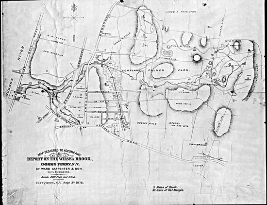
Photostat of Map Designed to Accompany Report on the Wilsea Brook,
Sept.
3, 1878
 Entire Record
 Catalog
 Transcription
This map, drawn by the civil engineering firm of Ward Carpenter and Sons in 1878, was used in a lawsuit brought by F. J. Stone on behalf of his uncle Cyrus Field, with whom he lived, against Moses T. Odell, the tenant of a nearby farm. For several years Odell had damned the Wilsea Brook in order to create an ice pond that provided him lucrative income during the winter. The pond was drained in the summer and the land used either for growing hay or for pasture land. Field, the financial investor who was best known for laying the first transatlantic cable, believed that the pond was a nuisance and a public health hazard that caused him to have the chills and fever of malaria. The lawsuit eventually was withdrawn when all parties agreed that Cyrus Field would drain the pond at his own expense. The original of this map has been lost.
This record is associated with: