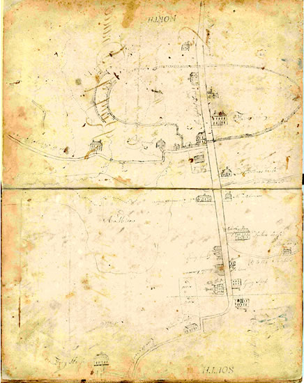
The Cochran Map of White Plains,
October 1776
This historic map of White Plains, dating to October 1776, was
hand-drawn by a soldier from Massachusetts just days before the
Battle of White Plains. It shows the area along Broadway (Route
22) from what is now downtown White Plains to the Town of North
Castle. Drawn on two pages of a ledger belonging to a carriage
maker in Massachusetts, it is believed to have been made by one
of two brothers, James and John Cochran, who were serving in the
Continental Army at the time. The map was returned to White Plains
some 200 years later.
This record is associated with:

